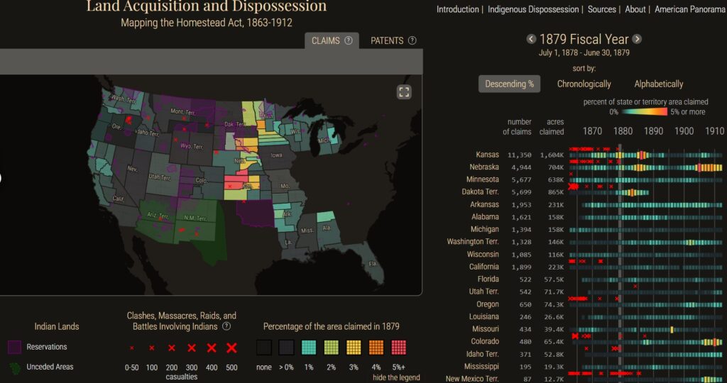
Julius Wilm, Robert K. Nelson, and Justin Madron, “Homesteading,” American Panorama, ed. Robert K. Nelson and Edward L. Ayers.
This project provides visual maps showing federal land boundaries, homestead patent hotspots, and a timeline with yearly activity among Indian Reservations throughout the 1862 American Homestead Act. As you scroll forward through time watching the activity, the general pattern of activity moves from the East to the West, as Americans begin pushing to colonize and build homes. Indian Reservations are facing a consistent number of battles, raids, and massacres from the start of the act up until roughly 1885, almost 15 years straight.
This Homestead Act project provides a clear, digital interface showing an evidence-based depiction of how federal land policy physically reshaped the American West and Midwest. As for the data, “This web map uses statistics and land district maps that were prepared in the early 1900s by General Land Office (GLO) staff.”