Data
Data Types
Primary Data: Historical land records from the U.S. General Land Office documenting homestead claims and patents filed between 1863 and 1912.
Data Format: Processed and published in geospatial formats (GeoJSON and shapefiles) and tabular data (CSV) for interoperability, mapping, and analysis within digital platforms.
Input Data/Source
Data from digitized federal land patent records and archival datasets was written by:
- US General Land Office. Record of Disposal of Public Lands under the Homestead Act, 1863-1912, Record Group 49, Call Number UD788, National Archives I, Washington, DC.
- US General Land Office. Quarterly Records of Disposal of the Public Lands, 1883-1909, Record Group 49, Call Number UD789, National Archives I, Washington, DC.
- US General Land Office. Statements of the Disposal of the Public and Indian Lands, 1885-1925, Record Group 49, Call Number UD790, National Archives I, Washington, DC.
- US General Land Office. Annual Report of the Commissioner of the General Land Office, Washington, DC, US Government Printing Office: 1882-84, 1888.
- US General Land Office. Diagrams of Land Districts, 1901-1901, Record Group 49, Call Number UD163F, National Archives I, Washington, DC.
Output Data
Processed Dataset: Data is not available for download.
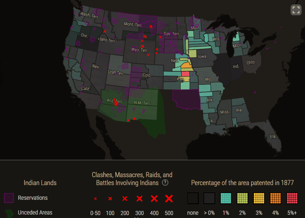
Visualization & Analysis: Presented through the interactive map image and timeline that lets the users explore patterns of settlers, land acquisition, and Indigenous native dispossession.
DH
This project exemplifies interpretive mapping but suffers from irresponsible data use by:
- Maintaining transparency by noting the Indigenous land loss as well as transitioning federal land changes.
- Failing to show reusable data that is openly shared.