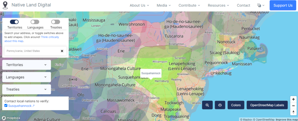
Native Land Digital provides a Mapbox-powered digital map of Indigenous cultures on a global scale, emphasizing breadth rather than depth. Clicking on the geographical territories of Indigenous peoples provides educational tools, points of contact for each group, and historical treaties signed by the groups and their respective colonial governments.

Invasion of America features an interactive, arcGIS-powered map of the United States displaying the over 1.5 billion acres of land “ceded” by or annexed from Indigenous Americans from 1776-1887. The site features a timelapse scroller that displays each parcel of land ceded by every treaty or executive order. Each parcel can be clicked on to view a transcript of the original treaty/order between the United States and the respective Indigenous tribe.