Methodology
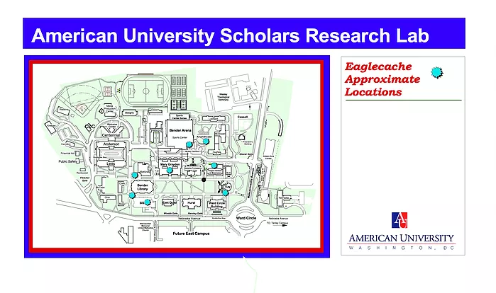
The Eaglecaching project was a school assignment for American University students in the AU Scholar program. Professors gave the students guidelines as to where they could place the geocaches, primarily based on the historical significance of the specific place and whether it was accessible to those searching for the caches. The students then came up with a list of cache locations and scouted out those locations in person. After they had chosen the exact spot, they used a GPS device to find the coordinates of the location. With all the coordinates collected, an info-graphic was made with all the sites listed and uploaded to the site.
In order to partake in Eaglecaching, you’re going to need a smartphone, portable GPS, or anything you can put coordinates into that will direct you to that location, such as Google Maps. As an example, we’ll look at the “Account of a Memory” cache. Listed on the page is a set of coordinates that will lead you to the cache, as well as a hint if you’re struggling to find it once you arrive at the location. You can input these coordinates of latitude 38.56285 and longitude 77.5293 in any basic GPS app or device, and it will give you directions to that point.
Once the cache is located, you can open it up and take a little trinket from inside, as long as you leave something in return. The idea behind the trinkets is you can see who else has found that cache, and you can simultaneously let other know you’ve found it. You can also form a collection of a trinket from each cache on the university grounds to show you’ve completed them all.
When I attempted to put the coordinates for the “Account of a Memory” caches, I ran into some difficulty. At first, my GPS programs weren’t showing any location based on what I put in. I had to go though and make sure it was formatted correctly, and after a few tries I got a location to show up. Unfortunately, it threw me into western China, which was way off the mark. Then I realized there was an inconsistency between pages. I added a negative sign to the longitude, and the result brought me to Virginia, which was a bit closer, but still no cigar. After some more tweaking, I finally got the correct location to show up. The lack of a tutorial on how to properly input coordinates into a GPS device hindered my progress, but I did eventually figure it out. I attempted to find some other caches, with varying degrees of success. Some did drop me into the university campus on the first try, others fell victim to the same problems as the first cache. Regardless, the inaccuracy of the coordinates is concerning.
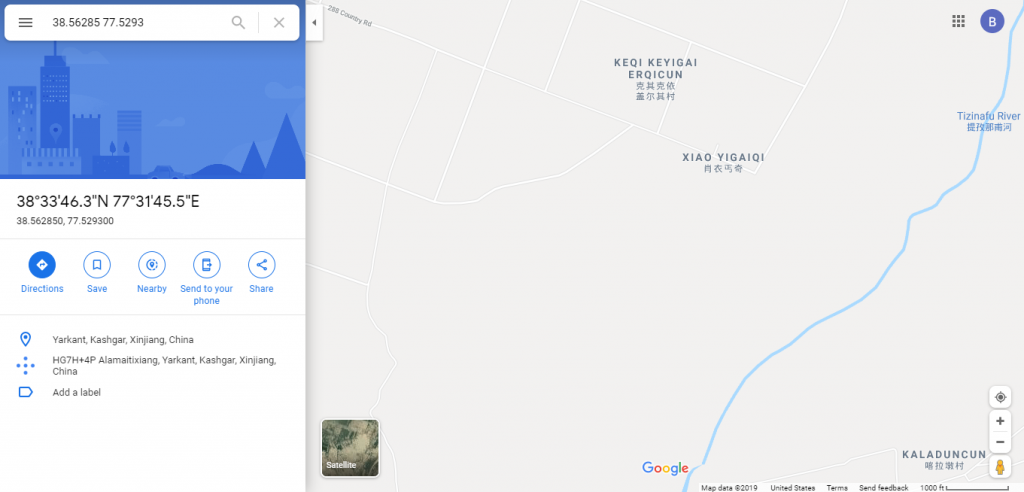
My first attempt, landing me in China. 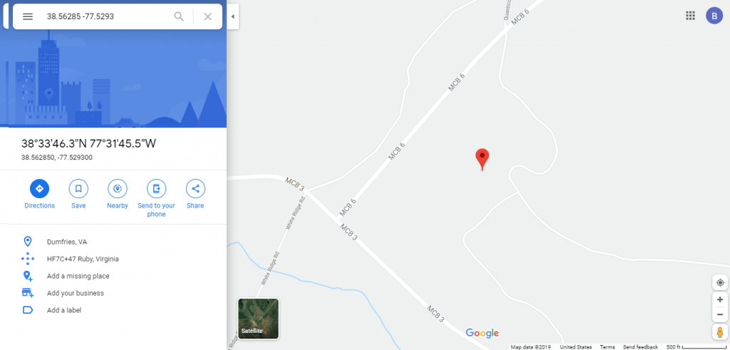
After some adjustments, my second attempt brought me to Virginia.
