Peers
This page is dedicated to focusing on projects that are similar in nature to Building History, in terms of content, functions, and visuals. This page also includes information about the context of Building History and why it exists in the Digital Humanities.
The Greene Street Project
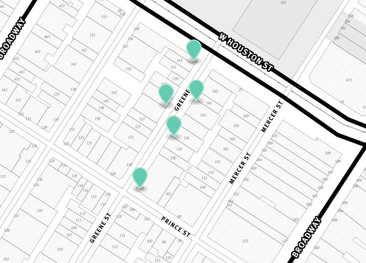
The Greene Street Project was created, written, and researched by William Easterly, Laura Freschi, and Steven Pennings at the NYU Developmental Research Institute. The Greene Street Project immerses users into Greene Street through the use of exquisite visuals, sounds, and extensive data about the historical changes that took place over time. This project was created based on the academic paper, A Long History of a Short Block: Four Centuries of Development Surprises on a Single Stretch of a New York City Street. As stated by NYU Development Research Institute, it is a “study of the historic development of the 486-feet strip of pavement, today known as Greene Street, between Houston and Prince Streets in the Soho neighborhood of Manhattan, New York. Today, the block is one of the richest in the city and the world”. When users first enter the project, music plays faintly in the background mimicking the atmosphere of on Greene Street. This aspect makes it feel as if users are actually standing on Greene Street and experiencing what it’s like in that specific location in New York. This project uses photos from the present day and photos from the past to illustrate how Greene Street has changed over the past four decades. Unlike Building History, each photo and video in the Greene Street project is utilized in a way that creates a narrative for this section of New York, creating a historical and cultural story through its alterations. The history that is shown throughout the years tells a story on how and why Greene Street changed. It is also unknown if this is an on-going project like Building History. However, just like Building History, the Greene Street project also incorporates an interactive map for users. Users are able to zoom in and out of the specific location that is being focused on, and see the surrounding streets and neighborhoods. Though, when zoomed deeper into the studied area, you are able to click a pinpoint on the map that opens up more photos that compare the appearance of stores from the 1800’s to now. The Greene Street project is an extraordinary creation that accurately displays the economic shift that Greene Street has had over the duration of time since the 1800s.
Cleveland Historical
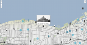
Cleveland Historical is a Digital Humanities project that lets you explore the people, places, and moments that shaped the city’s history. It is a free mobile app that puts Cleveland history at your fingertips. Developed by the Center for Public History + Digital Humanities (CPHDH) at Cleveland State University. The CPHDH seeks to transform how we teach, learn, and study history. In partnership with scholars, students, cultural organizations, and communities, CPHDH has developed state-of-the-art public history exhibits, interpretive research projects, teaching initiatives, and digital resources. The application has over 660+ stories about Cleveland’s rich history. You can even search specific stories in the Cleveland Historical using key words, collections, tags, etc. You can also view all the tours that the city has to offer on the site. It has over 30+ available tours and all the details about them including the locations and also who it is curated by. Similar with the Greene Street project, Cleveland Historical has a narrative aspect that is intertwined with into the map, which Building History lacks. Cleveland Historical is powered by Curatescape, a platform for storytelling. Users are able to grasp a good sense of how and why the city has gone through numerous of changes, and how those changes improved the city as a whole. Just like Building History, Cleveland Historical is an on-going project, as the graduate student staff at CPHDH continue to put forth their research efforts. Cleveland Historical also focuses on mapping the city’s change over time, similarly like Building History. It utilizes multiple interactive maps that are associated with selected parts throughout the city, showing what it looks like many years ago compared to its appearance today. Cleveland Historical is also powered by Omeka, a free digital publishing software. However, they created a special version of Omeka that is designed to create local project. Unfortunately, people have to pay for this special version which ruins the open source aspect.
Context
Digital Humanities projects that show space, place and location are important in the DH world because it displays the historical shift that occurs as years pass. It is a way of mapping how places were originally and how society and time has changed its appearance and culture. Building History is self-referencing the biography about themselves, Illinois Institute of Technology’s Mies campus. The creators are piecing this project together to create an online, interactive product that is about theirselves because they are essentially the only individuals that know and understand the history of this campus. It’s important to acknowledge the fact that it would be difficult for individuals that do not go to this university to understand and use this project.
Sources