Technologies/Tools used in BAC
The Borderlands Archives Cartography project uses several digital tools to collect and share historical data from newspapers along the U.S.–and Mexico border. To get the data in the project, the team gathers digitized newspapers records from online and libraries. To process the data, they organize it using mapping tools like OpenStreetMap and Carto which records when and where each newspaper was published. Finally to output data it uses a platform called Omeka to show the archives and maps on its website. These all help show borderland history throughout the website.
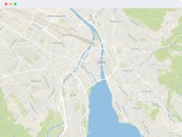
OpenStreetMap is one of the tools they used in BAC. This tool is a online mapping tool where anyone can add and edit map information. Specifically in the Borderlands Archives Cartography project, it is used to show where historical newspapers and archives are at the U.S. and Mexico border. BAC links each newspaper’s metadata like publication name, date, and place to the location on the map. Allowing users to explore where newspapers were published and how border communities shared information across time. Open Street mapping is also used for things like research, city planning, and emergency mapping outside of the project.
The Borderlands Archives Cartography project does a good job showing how it uses OpenStreetMap by including details like each newspaper’s name, place, and date. It explains where the data comes from and how the maps are made making it easy to follow. The project also links openstreetmapping on its page therfore you can use the site and learn more about it.
Link to Digital Humanities: The tool OpenStreetMap links to Digital Humanities by turning historical data into interactive maps that anyone can access. This fits DH goals like sharing knowledge/open access, using technology to study culture, and helping people explore history. By mapping newspapers from the border the project shows connections making untold stories easier to find.