Method
- Use GIS and urban-planning tools to map land-use, waterfront boundaries, green-space zones, accessibility, and transportation linkages (especially to transit nodes near RFK / Anacostia).
- Conduct community-based participatory research: public meetings, surveys, stakeholder interviews — as is already underway in the official 2025 redevelopment process for RFK site.
- Utilize environmental planning and green-infrastructure frameworks (e.g., stormwater management, habitat restoration, riparian buffer design) to ensure ecological sustainability and river health — as advocated by local environmental stakeholders.
- Employ public-health metrics and social impact assessment tools to gauge potential improvements in community health, well-being, and social cohesion — building on research linking green space to health outcomes.
Tools
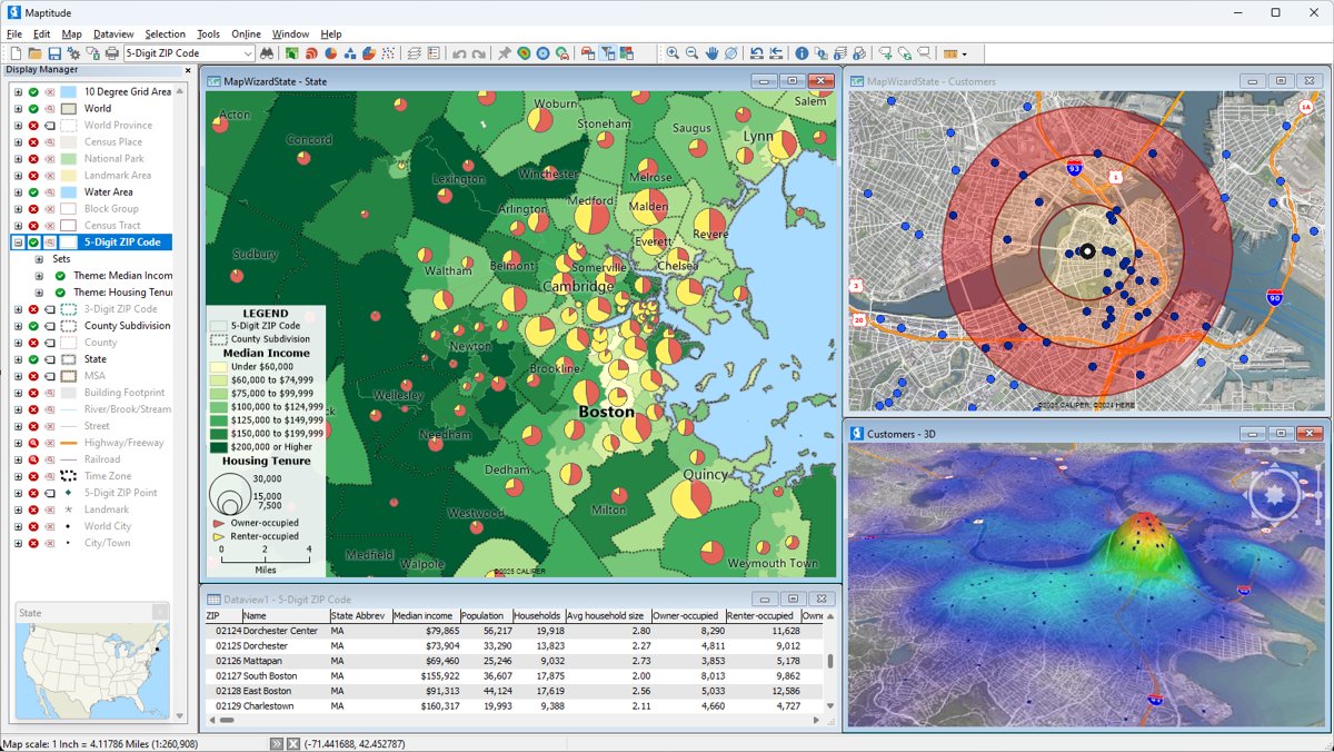
GIS Mapping & Urban Modeling
Geographic Information Systems (GIS) are used to analyze land use, housing density, transit access, and environmental conditions across the RFK site and surrounding neighborhoods. These tools help planners visualize how people move through the area, where affordable housing can be placed most effectively, and how the project connects to existing transportation and trail networks.
Participatory Research
This method involves directly engaging residents through public meetings, workshops, and surveys to gather local knowledge, concerns, and priorities. Community input ensures that the design of housing, retail, parks, and public spaces reflects the real needs of Southeast DC residents rather than being driven only by outside planners or developers.

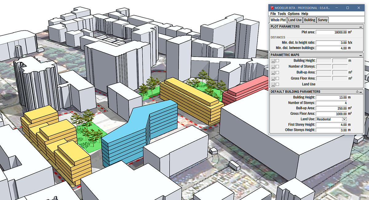
Urban Design Software
Urban design software is used to create detailed visualizations of buildings, streets, parks, and public spaces. These digital models allow residents, planners, and decision-makers to see how different design options would look over time and how the project can be built in phases without disrupting the surrounding community.

Environmental Modeling Tools
These tools simulate how stormwater moves across the site and how heat builds up in paved versus green areas. The results guide the placement of trees, gardens, green roofs, and permeable surfaces to reduce flooding risk, cool the neighborhood, and improve overall environmental conditions.
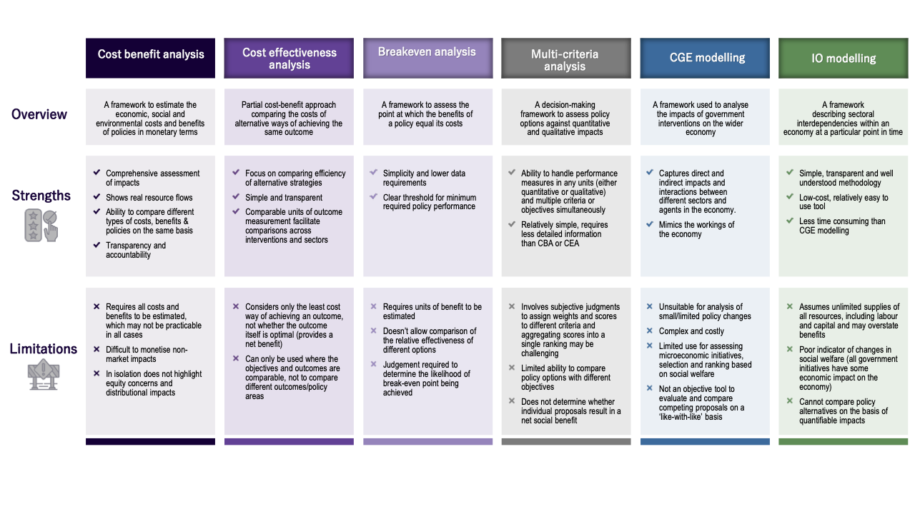
Economic Impact Tools
Economic modeling tools project how the redevelopment will affect local employment, small business growth, and retail spending. They estimate how many jobs the project may create, how much economic activity it could generate, and how these benefits would flow into the surrounding Southeast DC community.