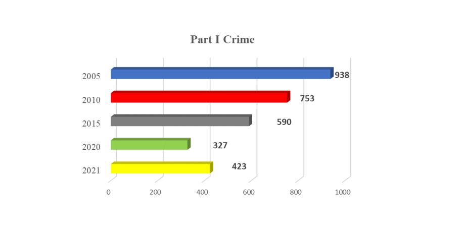
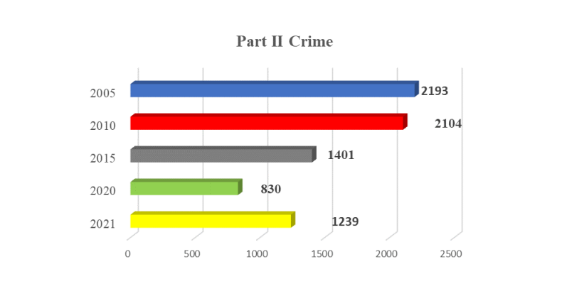
For our third project, the data used was the analysis of the crime data, organized through WCPD annual reports every year, and give thorough, accurate detailed reports of crimes ranging from 2008-2021. As of the most recent, the 2021 WCPD annual report states that “Crime is classified, counted, and reported in two distinctly different categories. Part I crimes consist of those crimes that one may consider to be the most serious crimes affecting society and are comprised of a very specific subset of crimes that are routinely reported. Part II crimes, are defined as any crime other than Part I crimes and are generally considered being less serious crimes (a secondary level of crime).” – https://west-chester.com/DocumentCenter/View/17703/2021-Complete-Year-End-Report
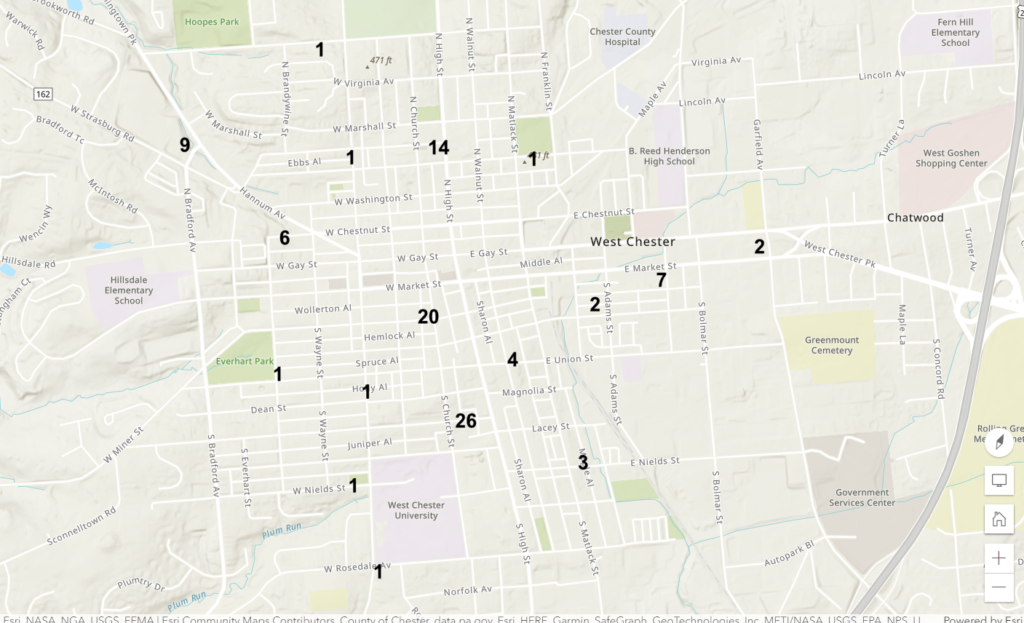
The output for the data we will be using is called arcgis.com to generate a map of West Chester Borough show casing the frequency of police calls in certain areas. Data will be collected from the WCPD’s annual report on crime that is published every year.